ZCZC MIATWOEP ALL
TTAA00 KNHC DDHHMM
TROPICAL WEATHER OUTLOOK
NWS NATIONAL HURRICANE CENTER MIAMI FL
1100 PM PDT WED SEP 7 2016
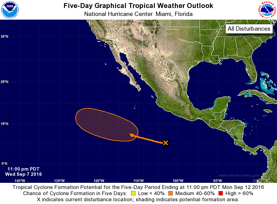
For the eastern North Pacific...east of 140 degrees west longitude:
1. A tropical wave located a few hundred miles south-southwest of
Acapulco, Mexico, continues to produce a large area of disorganized
showers and thunderstorms. A low pressure system is expected to
form in association with this wave over the weekend well south-
southwest of the southern tip of the Baja California peninsula.
Environmental conditions are expected to be conducive for gradual
development, and a tropical depression could form early next week
while the low moves west-northwestward.
* Formation chance through 48 hours...low...near 0 percent
* Formation chance through 5 days...medium...60 percent
Forecaster Brennan