ZCZC MIATWOAT ALL
TTAA00 KNHC DDHHMM
TROPICAL WEATHER OUTLOOK
NWS NATIONAL HURRICANE CENTER MIAMI FL
200 AM EDT MON AUG 1 2016
For the North Atlantic...Caribbean Sea and the Gulf of Mexico:
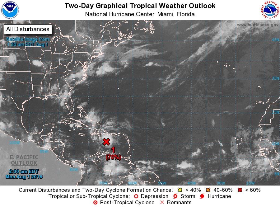
1. Thunderstorm activity associated with a strong and fast-moving
tropical wave located over the east-central Caribbean Sea about 200
miles south of the Dominican Republic has increased and become
significantly better organized overnight. Although this system still
lacks a closed surface circulation, recent satellite-derived surface
wind data and ship observations indicate that tropical-storm-force
winds of 40 to 45 mph are occurring on the northern and eastern
areas of the large disturbance. If this recent development trend
continues, then a tropical storm could form later today when the
wave moves into the central Caribbean Sea, or by early Tuesday as it
approaches Jamaica and moves into the western Caribbean Sea. Locally
heavy rains and gusty winds are expected over Hispaniola today, and
reaching Jamaica and Cuba by late Monday as the system moves
westward at 20 to 25 mph. Interests in these areas and elsewhere in
the western Caribbean Sea should continue to monitor the progress of
this strong disturbance. For additional information on this system,
see High Seas Forecasts issued by the National Weather Service.
* Formation chance through 48 hours...high...70 percent
* Formation chance through 5 days...high...80 percent
High Seas Forecasts issued by the National Weather Service can be
found under AWIPS header NFDHSFAT1, WMO header FZNT01 KWBC, and on
the Web at http://www.opc.ncep.noaa.gov/shtml/NFDHSFAT1.shtml.
Forecaster Stewart