


NHC Graphical Outlook Archive
|
« Earliest Available ‹ Earlier Later › Latest Available » |
GIS Shapefiles |
| Eastern North Pacific | Atlantic |
|
Tropical Weather Outlook Text
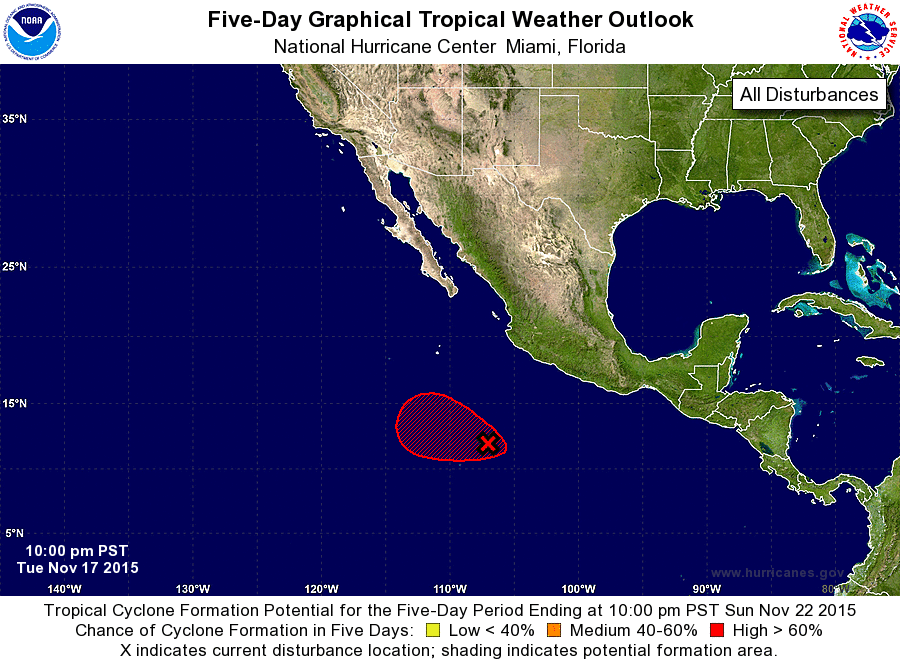
ZCZC MIATWOEP ALL
TTAA00 KNHC DDHHMM

TROPICAL WEATHER OUTLOOK
NWS NATIONAL HURRICANE CENTER MIAMI FL
1000 PM PST TUE NOV 17 2015

For the eastern North Pacific...east of 140 degrees west longitude:

1. A large area of disturbed weather centered several hundred miles
south to southwest of the southern tip of the Baja California
peninsula is associated with a broad area of low pressure. This
system remains poorly organized, but environmental conditions
are forecast to be conducive for a tropical depression to form
during the next few days while this disturbance moves toward the
west-northwest or northwest.
* Formation chance through 48 hours...medium...40 percent
* Formation chance through 5 days...high...70 percent

Forecaster Avila
List of Atlantic Outlooks (May 2023 - present)
List of East Pacific Outlooks (May 2023 - present)
List of Central Pacific Outlooks (May 2023 - present)
List of Atlantic Outlooks (July 2014 - April 2023)
List of East Pacific Outlooks (July 2014 - April 2023)
List of Central Pacific Outlooks (June 2019 - April 2023)
List of Atlantic Outlooks (June 2009 - June 2014)
List of East Pacific Outlooks (June 2009 - June 2014)