


NHC Graphical Outlook Archive
|
« Earliest Available ‹ Earlier Later › Latest Available » |
GIS Shapefiles |
| Eastern North Pacific | Atlantic |
|
Tropical Weather Outlook Text
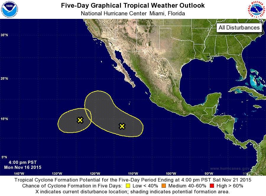
ZCZC MIATWOEP ALL
TTAA00 KNHC DDHHMM

TROPICAL WEATHER OUTLOOK
NWS NATIONAL HURRICANE CENTER MIAMI FL
400 PM PST MON NOV 16 2015

For the eastern North Pacific...east of 140 degrees west longitude:

1. Shower activity associated with an elongated area of low pressure
located about 1100 miles southwest of the southern tip of the Baja
California peninsula is gradually losing organization. Development
of this system is no longer anticipated.
* Formation chance through 48 hours...low...near 0 percent
* Formation chance through 5 days...low...near 0 percent

2. A large area of disturbed weather located about 750 miles
south-southwest of the southern tip of the Baja California
peninsula remains poorly organized. Some gradual development of this
system is possible during the next few days while it moves
west-northwestward at 5 to 10 mph.
* Formation chance through 48 hours...low...10 percent
* Formation chance through 5 days...low...20 percent

Forecaster Avila
List of Atlantic Outlooks (May 2023 - present)
List of East Pacific Outlooks (May 2023 - present)
List of Central Pacific Outlooks (May 2023 - present)
List of Atlantic Outlooks (July 2014 - April 2023)
List of East Pacific Outlooks (July 2014 - April 2023)
List of Central Pacific Outlooks (June 2019 - April 2023)
List of Atlantic Outlooks (June 2009 - June 2014)
List of East Pacific Outlooks (June 2009 - June 2014)