


NHC Graphical Outlook Archive
|
« Earliest Available ‹ Earlier Later › Latest Available » |
GIS Shapefiles |
| Eastern North Pacific | Atlantic |
|
Tropical Weather Outlook Text
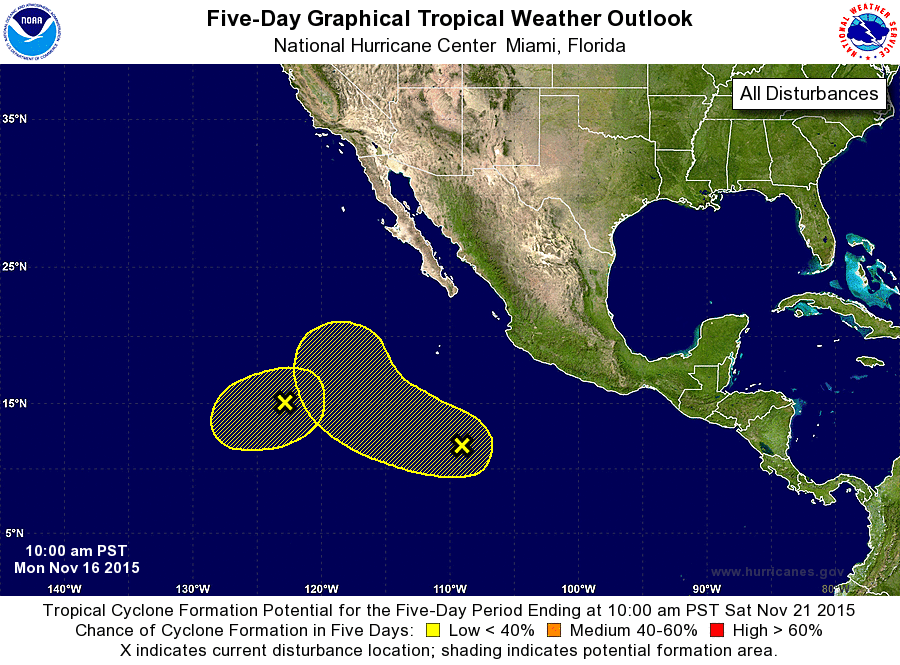
ZCZC MIATWOEP ALL
TTAA00 KNHC DDHHMM

TROPICAL WEATHER OUTLOOK
NWS NATIONAL HURRICANE CENTER MIAMI FL
1000 AM PST MON NOV 16 2015

For the eastern North Pacific...east of 140 degrees west longitude:

1. An elongated area of low pressure located about 1100 miles southwest
of the southern tip of the Baja California peninsula continues to
produce disorganized showers and thunderstorms. Development, if any,
of this system should be slow to occur while it moves little or
drifts eastward during the next few days and possibly merges with a
disturbance approaching from the east.
* Formation chance through 48 hours...low...10 percent
* Formation chance through 5 days...low...20 percent

2. A large area of disturbed weather has developed about 750 miles
south of the southern tip of the Baja California peninsula.  Some
gradual development of this system is possible during the next few
days while it moves west-northwestward at 5 to 10 mph and possibly
merges with a low pressure system located to its west.
* Formation chance through 48 hours...low...10 percent
* Formation chance through 5 days...low...20 percent

Forecaster Stewart
List of Atlantic Outlooks (May 2023 - present)
List of East Pacific Outlooks (May 2023 - present)
List of Central Pacific Outlooks (May 2023 - present)
List of Atlantic Outlooks (July 2014 - April 2023)
List of East Pacific Outlooks (July 2014 - April 2023)
List of Central Pacific Outlooks (June 2019 - April 2023)
List of Atlantic Outlooks (June 2009 - June 2014)
List of East Pacific Outlooks (June 2009 - June 2014)