


NHC Graphical Outlook Archive
|
« Earliest Available ‹ Earlier Later › Latest Available » |
GIS Shapefiles |
| Eastern North Pacific | Atlantic |
|
Tropical Weather Outlook Text
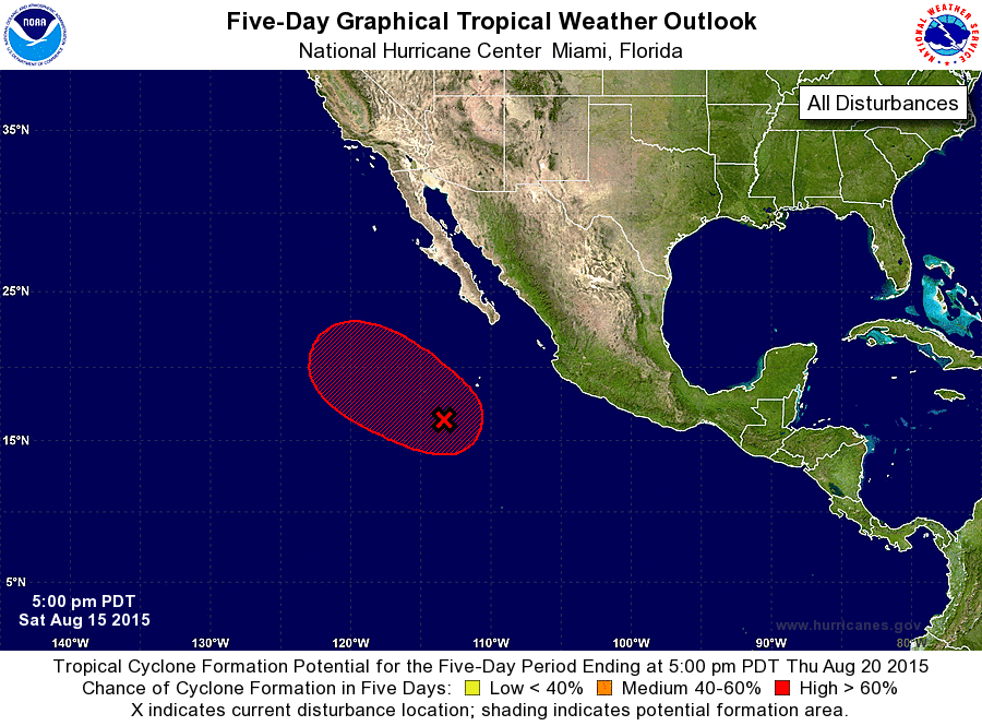
ZCZC MIATWOEP ALL
TTAA00 KNHC DDHHMM

TROPICAL WEATHER OUTLOOK
NWS NATIONAL HURRICANE CENTER MIAMI FL
500 PM PDT SAT AUG 15 2015

For the eastern North Pacific...east of 140 degrees west longitude:

1. Recent visible satellite images indicate that the large area of low
pressure centered about 500 miles south-southwest of the southern
tip of the Baja California peninsula has developed a well-defined
center of circulation.  The associated showers and thunderstorms
continue to show signs of organization, and this system is expected
to become a tropical depression or tropical storm this evening or on
Sunday while it moves west-northwestward at about 15 mph away from
the coast of Mexico.  Conditions are expected to become less
conducive for development by Monday when the system moves over
cooler waters.
* Formation chance through 48 hours...high...90 percent
* Formation chance through 5 days...high...90 percent

Forecaster Berg
List of Atlantic Outlooks (May 2023 - present)
List of East Pacific Outlooks (May 2023 - present)
List of Central Pacific Outlooks (May 2023 - present)
List of Atlantic Outlooks (July 2014 - April 2023)
List of East Pacific Outlooks (July 2014 - April 2023)
List of Central Pacific Outlooks (June 2019 - April 2023)
List of Atlantic Outlooks (June 2009 - June 2014)
List of East Pacific Outlooks (June 2009 - June 2014)