


NHC Graphical Outlook Archive
|
« Earliest Available ‹ Earlier Later › Latest Available » |
GIS Shapefiles |
| Eastern North Pacific | Atlantic |
|
Tropical Weather Outlook Text
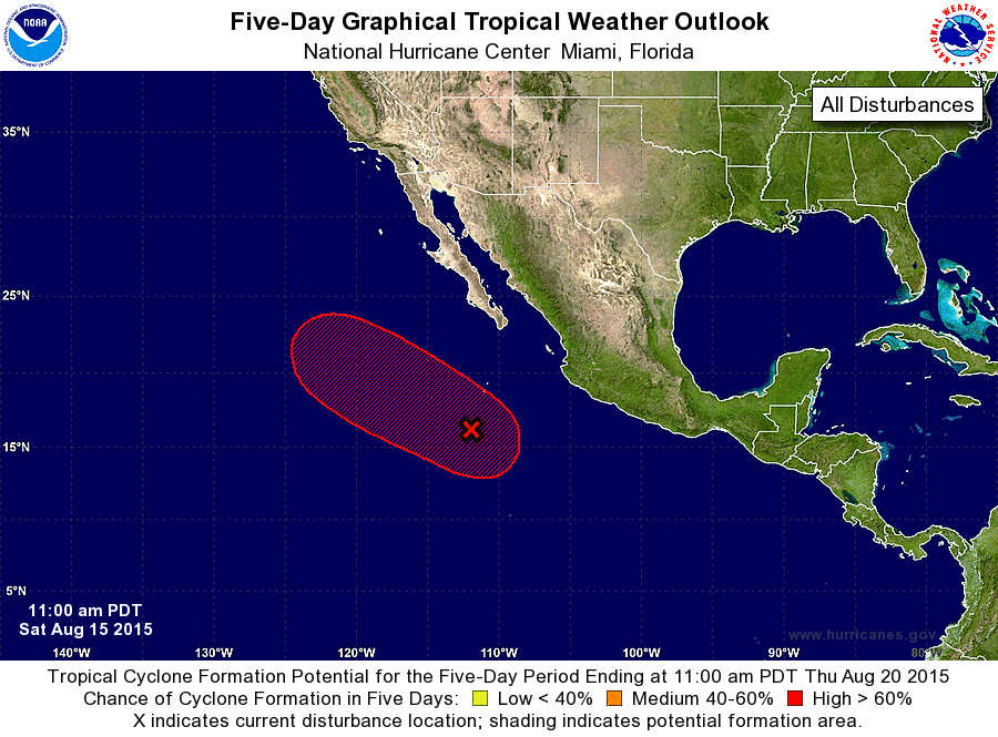
ZCZC MIATWOEP ALL
TTAA00 KNHC DDHHMM

TROPICAL WEATHER OUTLOOK
NWS NATIONAL HURRICANE CENTER MIAMI FL
1100 AM PDT SAT AUG 15 2015

For the eastern North Pacific...east of 140 degrees west longitude:

1. Shower activity associated with a large area of low pressure
centered about 475 miles south-southwest of the southern tip of the
Baja California peninsula continues to show signs of organization.
However, the system does not appear to have a well-defined center at
this time. Environmental conditions remain favorable for a tropical
depression to form later today or Sunday while the system moves
west-northwestward at 10 to 15 mph away from the coast of Mexico. By
Monday, conditions are expected to become less conducive for
development.
* Formation chance through 48 hours...high...90 percent
* Formation chance through 5 days...high...90 percent

Forecaster Avila
List of Atlantic Outlooks (May 2023 - present)
List of East Pacific Outlooks (May 2023 - present)
List of Central Pacific Outlooks (May 2023 - present)
List of Atlantic Outlooks (July 2014 - April 2023)
List of East Pacific Outlooks (July 2014 - April 2023)
List of Central Pacific Outlooks (June 2019 - April 2023)
List of Atlantic Outlooks (June 2009 - June 2014)
List of East Pacific Outlooks (June 2009 - June 2014)