


NHC Graphical Outlook Archive
|
« Earliest Available ‹ Earlier Later › Latest Available » |
GIS Shapefiles |
| Eastern North Pacific | Atlantic |
|
Tropical Weather Outlook Text
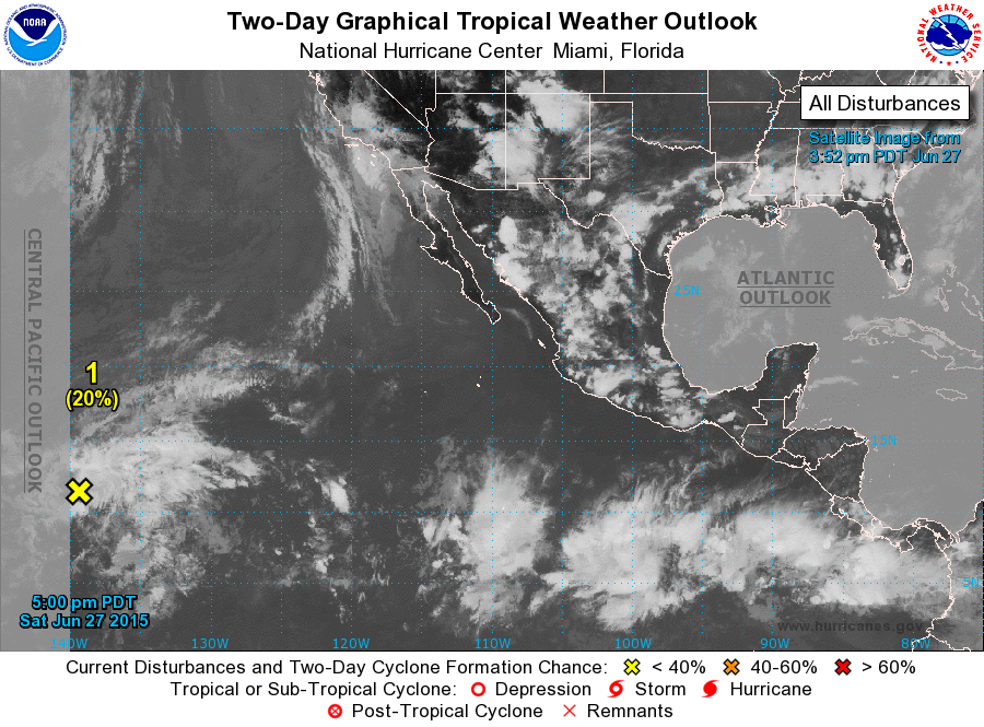
ZCZC MIATWOEP ALL
TTAA00 KNHC DDHHMM

TROPICAL WEATHER OUTLOOK
NWS NATIONAL HURRICANE CENTER MIAMI FL
500 PM PDT SAT JUN 27 2015

For the eastern North Pacific...east of 140 degrees west longitude:

1. Disorganized cloudiness and showers continue in association with an
area of low pressure located about 1200 miles east-southeast of the
Big Island of Hawaii.  Some slow development of this system is still
possible during the next day or two before stronger upper-level
winds are expected to inhibit tropical cyclone formation.  This
disturbance is moving into the central Pacific basin, and further
information can be found in Tropical Weather Outlooks issued by the
Central Pacific Hurricane Center.
* Formation chance through 48 hours...low...20 percent
* Formation chance through 5 days...low...20 percent

Tropical Weather Outlooks issued by the Central Pacific Hurricane
Center can be found under WMO header ACPN50 PHFO and AWIPS header
HFOTWOCP.

Forecaster Kimberlain
List of Atlantic Outlooks (May 2023 - present)
List of East Pacific Outlooks (May 2023 - present)
List of Central Pacific Outlooks (May 2023 - present)
List of Atlantic Outlooks (July 2014 - April 2023)
List of East Pacific Outlooks (July 2014 - April 2023)
List of Central Pacific Outlooks (June 2019 - April 2023)
List of Atlantic Outlooks (June 2009 - June 2014)
List of East Pacific Outlooks (June 2009 - June 2014)