


NHC Graphical Outlook Archive
|
« Earliest Available ‹ Earlier Later › Latest Available » |
GIS Shapefiles |
| Eastern Pacific | Atlantic |
|
Tropical Weather Outlook Text
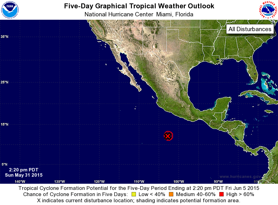
ZCZC MIATWOEP ALL
TTAA00 KNHC DDHHMM

SPECIAL TROPICAL WEATHER OUTLOOK
NWS NATIONAL HURRICANE CENTER MIAMI FL
220 PM PDT SUN MAY 31 2015

For the eastern North Pacific...east of 140 degrees west longitude:

Special Tropical Weather Outlook issued to indicate the formation
of Tropical Depression Two-E.

The National Hurricane Center is issuing advisories on Hurricane
Andres, located several hundred miles southwest of the southern tip
of the Baja California peninsula.

1. Updated:  Satellite imagery indicates that thunderstorm activity
associated with the well-defined area of low pressure located about
375 miles south-southwest of Acapulco, Mexico, has become
sufficiently well organized to designate the system as a tropical
depression.  A special advisory on Tropical Depression Two-E will be
issued soon.
* Formation chance through 48 hours...high...near 100 percent
* Formation chance through 5 days...high...near 100 percent

Forecaster Kimberlain/Pasch
List of Atlantic Outlooks (May 2023 - present)
List of East Pacific Outlooks (May 2023 - present)
List of Central Pacific Outlooks (May 2023 - present)
List of Atlantic Outlooks (July 2014 - April 2023)
List of East Pacific Outlooks (July 2014 - April 2023)
List of Central Pacific Outlooks (June 2019 - April 2023)
List of Atlantic Outlooks (June 2009 - June 2014)
List of East Pacific Outlooks (June 2009 - June 2014)