


NHC Graphical Outlook Archive
|
« Earliest Available ‹ Earlier Later › Latest Available » |
| Eastern Pacific | Atlantic |
|
|
(mouse over weather symbols for details; click on weather symbols or disturbance numbers to switch views) |
Tropical Weather Outlook Text
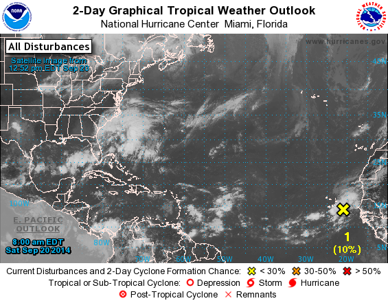
TROPICAL WEATHER OUTLOOK
NWS NATIONAL HURRICANE CENTER MIAMI FL
800 AM EDT SAT SEP 20 2014

For the North Atlantic...Caribbean Sea and the Gulf of Mexico:

1. Showers and thunderstorms have become more concentrated in
association with an elongated area of low pressure located a couple
hundred miles east-southeast of the Cape Verde Islands. However,
development of this system is becoming less likely due to
increasingly unfavorable upper-level winds.  This low should move
generally northwestward and could bring heavy rainfall to portions
of the Cape Verde Islands later this weekend.
* Formation chance through 48 hours...low...10 percent.
* Formation chance through 5 days...low...10 percent.

Forecaster Kimberlain
List of Atlantic Outlooks (May 2023 - present)
List of East Pacific Outlooks (May 2023 - present)
List of Central Pacific Outlooks (May 2023 - present)
List of Atlantic Outlooks (July 2014 - April 2023)
List of East Pacific Outlooks (July 2014 - April 2023)
List of Central Pacific Outlooks (June 2019 - April 2023)
List of Atlantic Outlooks (June 2009 - June 2014)
List of East Pacific Outlooks (June 2009 - June 2014)