ZCZC MIATWOEP ALL
TTAA00 KNHC DDHHMM
Tropical Weather Outlook
NWS National Hurricane Center Miami FL
500 PM PDT Fri Aug 12 2022
For the eastern North Pacific...east of 140 degrees west longitude:
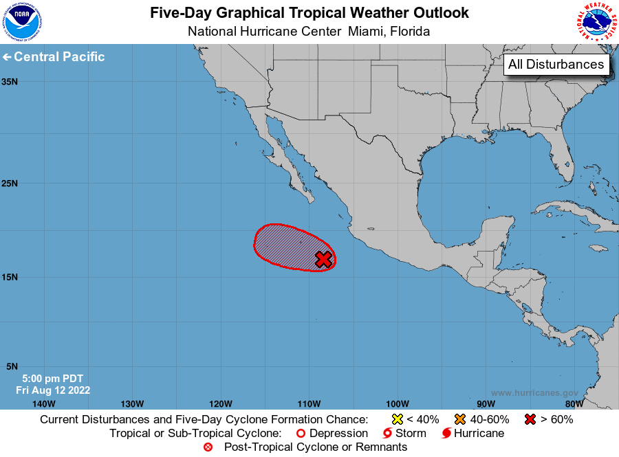
1. Offshore of Southwestern Mexico:
Showers and thunderstorms associated with an area of low pressure
located a few hundred miles west-southwest of Manzanillo, Mexico,
have changed little in organization since yesterday and are confined
to the western portion of its circulation. A small increase in the
organization of the associated shower and thunderstorm activity
would result in the formation of a short-lived tropical depression,
likely tonight or on Saturday, while the system moves
west-northwestward to northwestward at about 10 mph. By Sunday,
upper-level winds are forecast to strengthen over the system, and
further development is not expected.
* Formation chance through 48 hours...high...70 percent.
* Formation chance through 5 days...high...70 percent.
Forecaster Reinhart