ZCZC MIATWOEP ALL
TTAA00 KNHC DDHHMM
Tropical Weather Outlook
NWS National Hurricane Center Miami FL
500 AM PDT Fri Aug 12 2022
For the eastern North Pacific...east of 140 degrees west longitude:
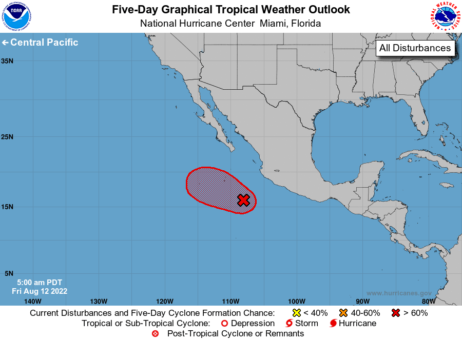
1. Offshore of Southwestern Mexico:
Showers and thunderstorms have decreased in association with an area
of low pressure located a few hundred miles southwest of Manzanillo,
Mexico. Although the system has lost organization, it still will
likely become a short-lived tropical cyclone during the next day or
two before upper-level winds become unfavorable for development on
Sunday. The low is forecast to move west-northwestward at about 10
mph well offshore the coast of Mexico during the next few days.
* Formation chance through 48 hours...high...70 percent.
* Formation chance through 5 days...high...70 percent.
Forecaster Cangialosi