ZCZC MIATWOEP ALL
TTAA00 KNHC DDHHMM
Tropical Weather Outlook
NWS National Hurricane Center Miami FL
500 AM PDT Thu Aug 11 2022
For the eastern North Pacific...east of 140 degrees west longitude:
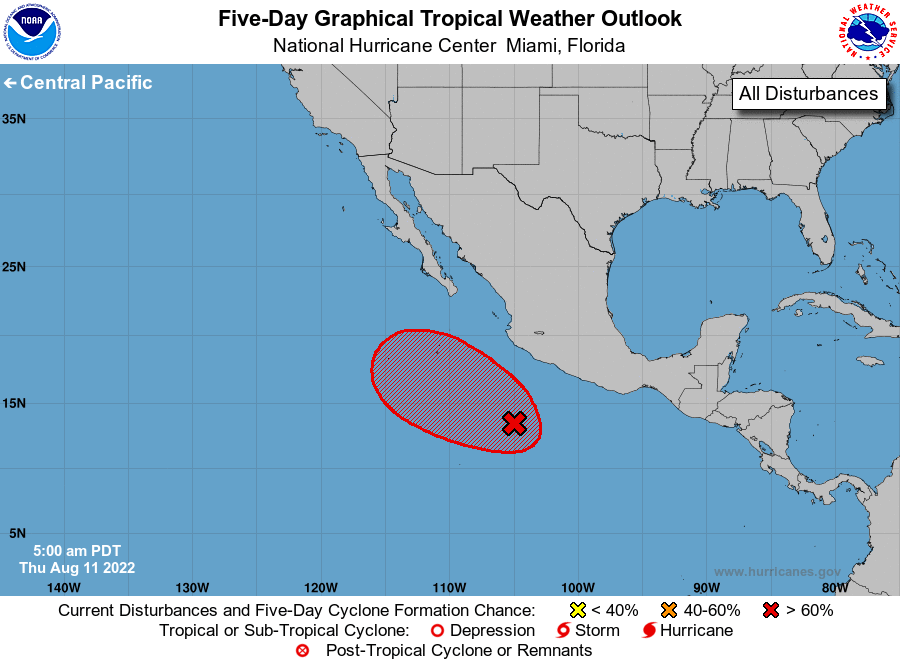
1. Offshore of Southwestern Mexico:
A very broad area of low pressure is located several hundred miles
off the southwestern coast of Mexico. Although this system is
showing some signs of organization in satellite imagery, shower and
thunderstorm activity has decreased since yesterday. In addition,
overnight satellite-derived wind data indicate that the system does
not have a well-defined center of circulation at the surface.
Environmental conditions still appear conducive for development, and
a tropical depression is likely to form by the end of the weekend
while it moves west-northwestward or northwestward at about 10 mph,
well offshore the coast of Mexico. The system is forecast to move
into an environment that is less conducive for development early
next week, and further development will be unlikely at that time.
* Formation chance through 48 hours...medium...60 percent.
* Formation chance through 5 days...high...80 percent.
Forecaster D. Zelinsky