ZCZC MIATWOEP ALL
TTAA00 KNHC DDHHMM
Tropical Weather Outlook
NWS National Hurricane Center Miami FL
1100 PM PDT Wed Aug 10 2022
For the eastern North Pacific...east of 140 degrees west longitude:
Active Systems:
The National Hurricane Center has issued the last advisory on
Post-Tropical Cyclone Howard, located about 800 miles west of the
southern tip of the Baja California peninsula.
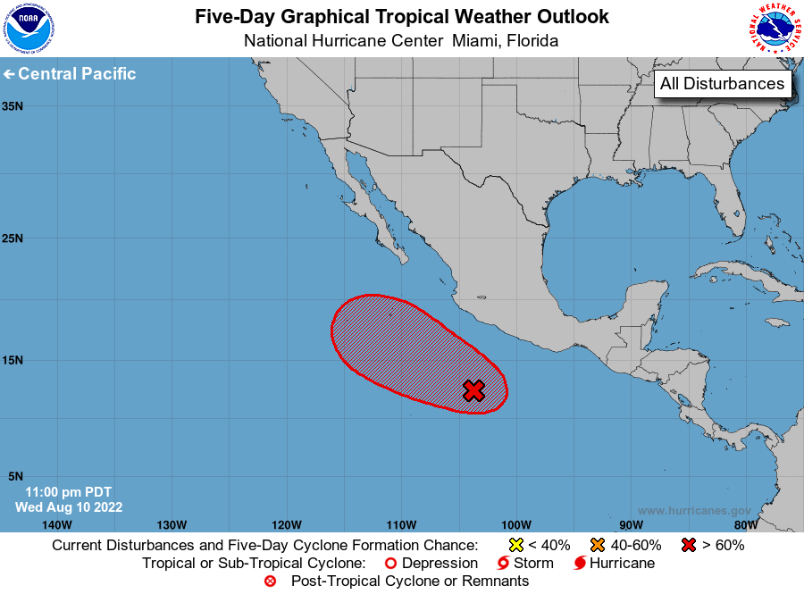
1. Offshore of Southwestern Mexico:
A broad area of low pressure located several hundred miles off the
southwestern coast of Mexico continues to produce disorganized
showers and thunderstorms, although a little more rotation has
become evident in the cloud pattern since earlier today.
Environmental conditions appear conducive for additional
development of this system, and a tropical depression is likely to
form by this weekend while it moves west-northwestward to
northwestward at about 10 mph, well offshore the coast of Mexico.
* Formation chance through 48 hours...medium...60 percent.
* Formation chance through 5 days...high...80 percent.
Forecaster Berg