ZCZC MIATWOEP ALL
TTAA00 KNHC DDHHMM
Tropical Weather Outlook
NWS National Hurricane Center Miami FL
500 AM PDT Sat Jul 23 2022
For the eastern North Pacific...east of 140 degrees west longitude:
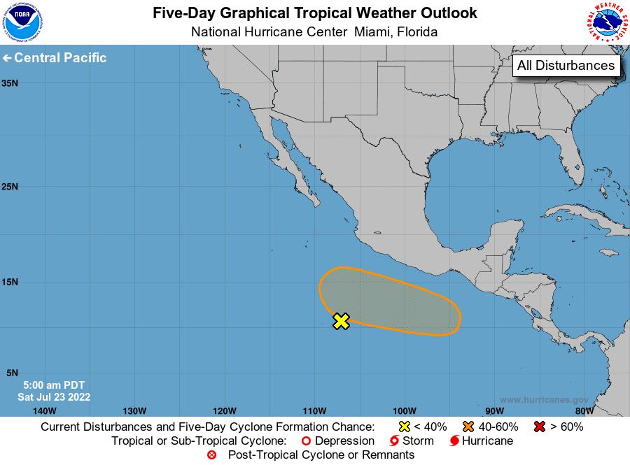
1. Offshore of Southwestern Mexico:
Satellite-derived surface wind data indicate that the surface
trough located several hundred miles south-southwest of the coast
of southwestern Mexico has become less defined while producing
limited shower activity. Therefore, the development of this system
is no longer anticipated.
* Formation chance through 48 hours...low...near 0 percent.
* Formation chance through 5 days...low...near 0 percent.
2. Offshore of Central America and Southern Mexico:
An area of low pressure is forecast to form during the next day or
two a few hundred miles south of extreme southeastern Mexico.
Gradual development is expected thereafter, and a tropical
depression could form by the middle of next week while the system
moves generally westward at 10 to 15 mph.
* Formation chance through 48 hours...low...near 0 percent.
* Formation chance through 5 days...medium...60 percent.
Forecaster Roberts/Brown