ZCZC MIATWOEP ALL
TTAA00 KNHC DDHHMM
Tropical Weather Outlook
NWS National Hurricane Center Miami FL
500 PM PDT Thu Jul 14 2022
For the eastern North Pacific...east of 140 degrees west longitude:
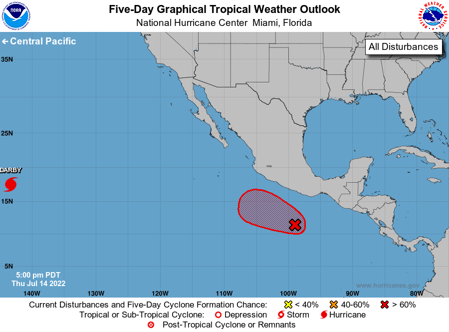
1. Offshore of Southern Mexico:
Showers and thunderstorms associated with an area of low pressure
located several hundred miles south of Acapulco, Mexico, have
continued to become better organized today. Environmental
conditions appear conducive for additional development, and a
tropical depression is expected to form well offshore of the coast
of southern Mexico within the next day or so. The disturbance is
forecast to move westward to west-northwestward at 10 to 15 mph
while remaining offshore of the southern and southwestern coasts
of Mexico.
* Formation chance through 48 hours...high...90 percent.
* Formation chance through 5 days...high...90 percent.
Forecaster Brown