ZCZC MIATWOEP ALL
TTAA00 KNHC DDHHMM
Tropical Weather Outlook
NWS National Hurricane Center Miami FL
1100 PM PDT Sat Jun 11 2022
For the eastern North Pacific...east of 140 degrees west longitude:
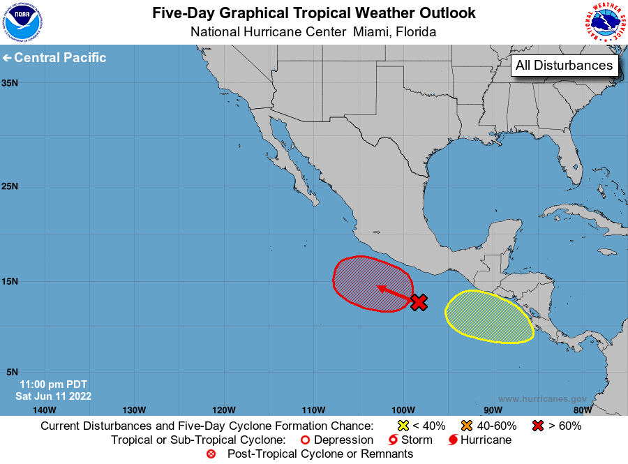
1. Off the coast of southwestern Mexico:
A broad low pressure area located a couple of hundred miles south
of the southwest coast of Mexico is producing disorganized showers
and thunderstorms. Environmental conditions are expected to become
conducive for gradual development of this system, and a tropical
depression is likely to form during the early or middle part of
next week while the system moves slowly northwestward off the
southwestern coast of Mexico.
* Formation chance through 48 hours...low...30 percent.
* Formation chance through 5 days...high...80 percent.
2. Off the coast of Central America:
An area of low pressure is expected to form during the next few days
south or southwest off the coast of Central America. Subsequent
gradual development of this system is possible as it moves slowly
northwestward.
* Formation chance through 48 hours...low...near 0 percent.
* Formation chance through 5 days...low...20 percent.
Forecaster Beven/Bucci