ZCZC MIATWOEP ALL
TTAA00 KNHC DDHHMM
Tropical Weather Outlook
NWS National Hurricane Center Miami FL
1100 AM PDT Thu May 26 2022
For the eastern North Pacific...east of 140 degrees west longitude:
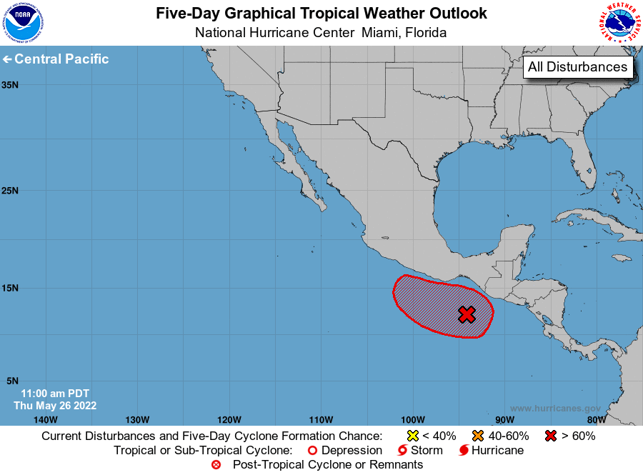
1. South of the Gulf of Tehuantepec:
Shower and thunderstorm activity is showing signs of organization
near a surface trough located a few hundred miles south-southeast of
the Gulf of Tehuantepec. Environmental conditions appear conducive
for additional development, and a tropical depression is likely to
form by this weekend while the system moves west-northwestward or
northwestward at 5 to 10 mph. Regardless of development, locally
heavy rains will be possible along coastal sections of Guatemala
and southern Mexico during the next few days, and interests in
these areas should monitor the progress of this system.
* Formation chance through 48 hours...high...70 percent.
* Formation chance through 5 days...high...90 percent.
Forecaster Papin/Bucci