ZCZC MIATWOEP ALL
TTAA00 KNHC DDHHMM
Tropical Weather Outlook
NWS National Hurricane Center Miami FL
500 AM PDT Thu May 26 2022
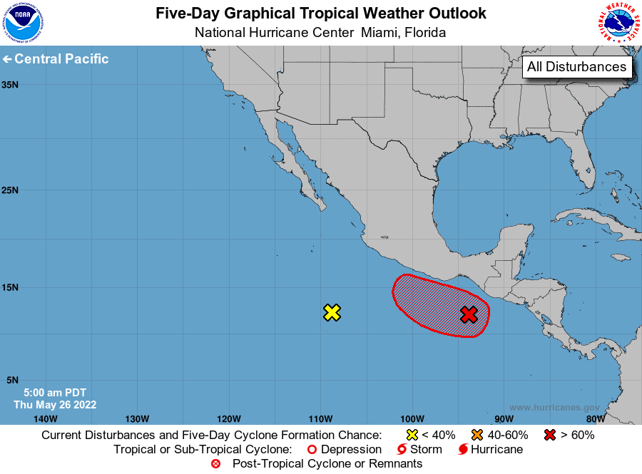
For the eastern North Pacific...east of 140 degrees west longitude:
1. South of the Gulf of Tehuantepec:
Shower and thunderstorm activity has increased and become a bit more
concentrated near a surface trough located a few hundred miles
south-southeast of the Gulf of Tehuantepec. Environmental
conditions appear conducive for gradual development, and a tropical
depression is likely to form by this weekend while the system moves
west-northwestward or northwestward at 5 to 10 mph. Interests in
southern Mexico should monitor the progress of this system.
* Formation chance through 48 hours...medium...60 percent.
* Formation chance through 5 days...high...90 percent.
2. Central portion of the eastern Pacific:
Shower and thunderstorm activity has diminished in association with
the trough of low pressure located several hundred miles off the
coast of southwestern Mexico. Environmental conditions are becoming
increasingly unfavorable, and significant development of this
system is no longer expected.
* Formation chance through 48 hours...low...near 0 percent.
* Formation chance through 5 days...low...near 0 percent.
Forecaster Papin