ZCZC MIATWOEP ALL
TTAA00 KNHC DDHHMM
Tropical Weather Outlook
NWS National Hurricane Center Miami FL
1100 PM PDT Wed Oct 6 2021
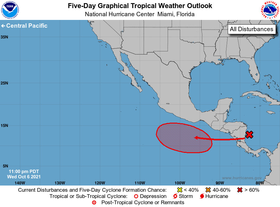
For the eastern North Pacific...east of 140 degrees west longitude:
1. A tropical wave is producing a large area of disorganized showers
and thunderstorms over the southwestern Caribbean Sea and portions
of Central America. This system is expected to move westward and
emerge over the eastern Pacific Ocean in a day or so. Environmental
conditions are forecast to be conducive for gradual development,
and a tropical depression is likely to form over the weekend or
early next week while the system moves westward to
west-northwestward.
* Formation chance through 48 hours...low...10 percent.
* Formation chance through 5 days...high...70 percent.
Forecaster Cangialosi