ZCZC MIATWOAT ALL
TTAA00 KNHC DDHHMM
Tropical Weather Outlook
NWS National Hurricane Center Miami FL
200 AM EDT Thu Oct 7 2021
For the North Atlantic...Caribbean Sea and the Gulf of Mexico:
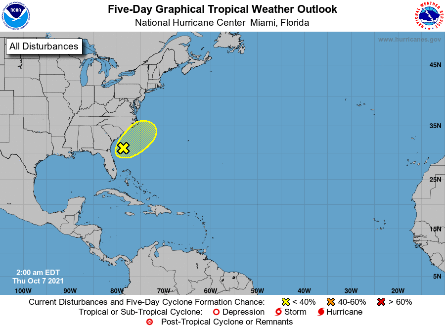
1. A weak area of low pressure located about 150 miles off the coast
of northeastern Florida and Georgia is producing disorganized
showers and thunderstorms. Strong upper-level winds should limit
significant tropical development during the next few days while the
low moves northward and then northeastward off the southeastern
coast of the United States. By the weekend, the system is forecast
to interact with a front, which could also limit tropical
development. Regardless of development, this system could bring
gusty winds and locally heavy rain to portions of the Carolinas late
this week and this weekend.
* Formation chance through 48 hours...low...10 percent.
* Formation chance through 5 days...low...20 percent.
Forecaster Cangialosi