ZCZC MIATWOEP ALL
TTAA00 KNHC DDHHMM
Tropical Weather Outlook
NWS National Hurricane Center Miami FL
1100 AM PDT Tue Aug 24 2021
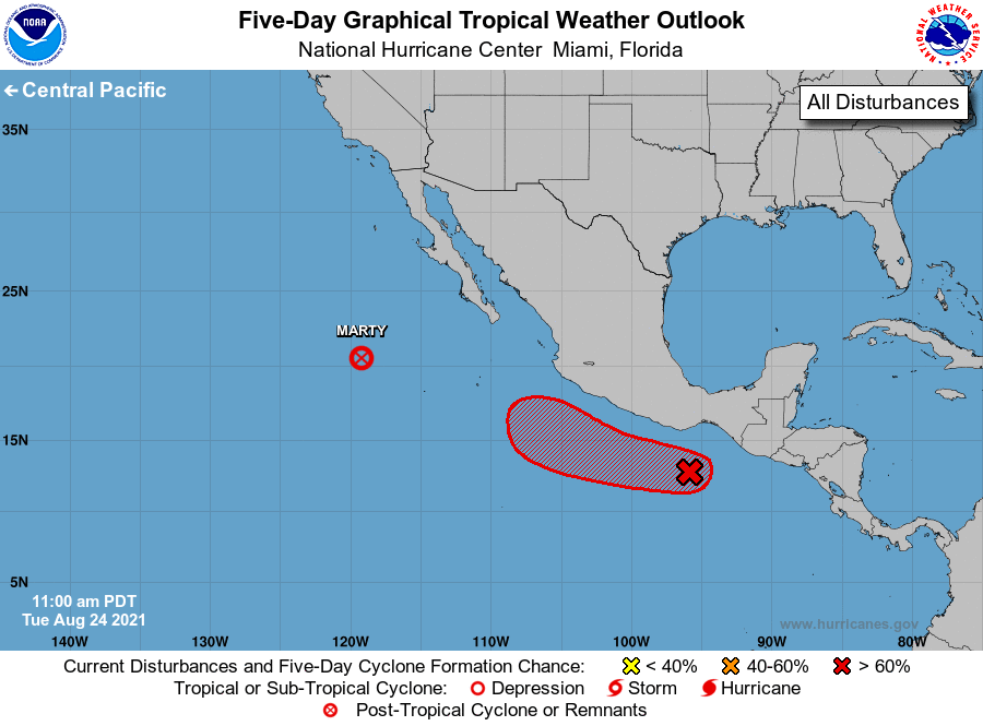
For the eastern North Pacific...east of 140 degrees west longitude:
The National Hurricane Center is issuing advisories on recently
downgraded Tropical Depression Marty, located more than 500 miles
west-southwest of the southern tip of the Baja California peninsula.
1. Recent satellite-derived surface wind data indicate that the low
pressure system located less than 200 miles offshore of the
southeastern coast of Mexico has become a little better defined
since yesterday. Shower and thunderstorm activity is also beginning
to show some signs of organization, and a tropical depression is
expected to form during the next day or so. The system is forecast
to move westward to west-northwestward at 10 to 15 mph this week,
remaining offshore the coast of southwestern Mexico.
* Formation chance through 48 hours...high...90 percent.
* Formation chance through 5 days...high...90 percent.
Forecaster Stewart