ZCZC MIATWOEP ALL
TTAA00 KNHC DDHHMM
Tropical Weather Outlook
NWS National Hurricane Center Miami FL
500 PM PDT Tue Aug 24 2021
For the eastern North Pacific...east of 140 degrees west longitude:
The National Hurricane Center has issued the last advisory on
Post-Tropical Cyclone Marty, located more than 600 miles
west-southwest of the southern tip of the Baja California peninsula.
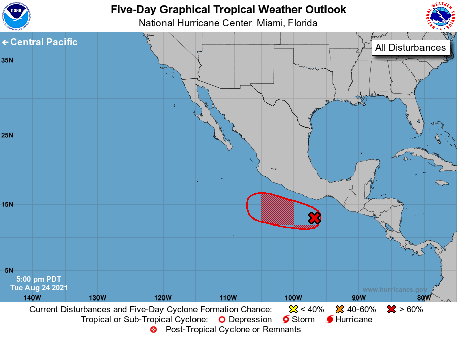
1. Showers and thunderstorms have increased in coverage since yesterday
and continue to show signs of organization in association with a low
pressure system located a couple of hundred miles south-southwest of
the Gulf of Tehuantepec. Environmental conditions remain conducive
for additional development, and a tropical depression is expected to
form during the next day or so. The system is forecast to move
westward to west-northwestward at 10 to 15 mph this week, remaining
offshore of the coast of southwestern Mexico.
* Formation chance through 48 hours...high...90 percent.
* Formation chance through 5 days...high...90 percent.
Forecaster Reinhart/Pasch