ZCZC MIATWOEP ALL
TTAA00 KNHC DDHHMM
Tropical Weather Outlook
NWS National Hurricane Center Miami FL
1100 PM PDT Tue Jul 13 2021
For the eastern North Pacific...east of 140 degrees west longitude:
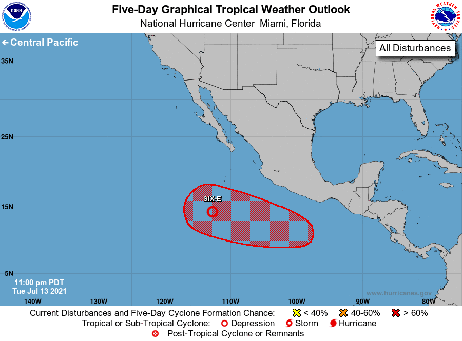
1. Satellite imagery indicates that an area of low pressure located
about 650 miles south-southwest of the southern tip of the Baja
California peninsula continues to show signs of organization, and
recent satellite wind data indicate that the circulation is
becoming better defined. Environmental conditions remain favorable
for continued development, and a tropical depression is likely to
form later today while the low moves west-northwestward at about 15
mph.
* Formation chance through 48 hours...high...90 percent.
* Formation chance through 5 days...high...90 percent.
2. An area of low pressure is forecast to develop well south of the
coast of southern Mexico late this week and move westward at 10 to
15 mph. Environmental conditions are expected to be favorable for
gradual development, and a tropical depression is likely to form
this weekend well offshore of the southwestern coast of Mexico.
* Formation chance through 48 hours...low...near 0 percent.
* Formation chance through 5 days...high...70 percent.
Forecaster Beven