ZCZC MIATWOEP ALL
TTAA00 KNHC DDHHMM
Tropical Weather Outlook
NWS National Hurricane Center Miami FL
1100 AM PDT Wed Jun 16 2021
For the eastern North Pacific...east of 140 degrees west longitude:
The National Hurricane Center has issued the last advisory on
Post-Tropical Cyclone Carlos, located about 2000 miles
west-southwest of the southern tip of the Baja California peninsula.
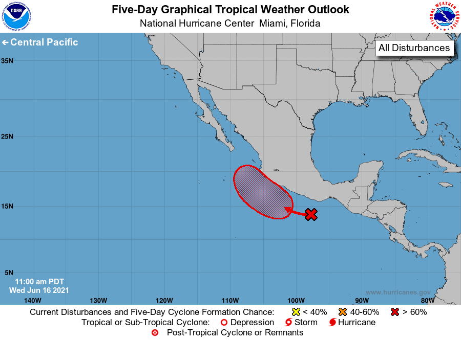
1. A surface trough of low pressure is producing a large area of
disorganized showers and thunderstorms extending several hundred
miles south of the coast of southern Mexico. Environmental
conditions appear conducive for development of this system, and a
tropical depression is likely to form late this week while moving
west-northwestward at 5 to 10 mph, near the coast of southwestern
Mexico. Regardless of development, heavy rains are likely over
coastal sections of the Mexican states of Oaxaca, Guerrero,
Michoacan, Colima, and Jalisco during the next few days, which could
cause life-threatening flash floods and mud slides. Interests in
these areas should monitor the progress of this system through the
weekend.
* Formation chance through 48 hours...medium...40 percent.
* Formation chance through 5 days...high...70 percent.
Forecaster Berg