ZCZC MIATWOEP ALL
TTAA00 KNHC DDHHMM
Tropical Weather Outlook
NWS National Hurricane Center Miami FL
500 PM PDT Wed Oct 7 2020
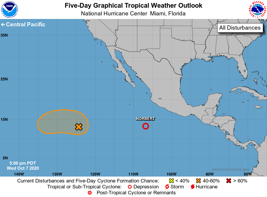
For the eastern North Pacific...east of 140 degrees west longitude:
The National Hurricane Center is issuing advisories on recently
downgraded Tropical Depression Norbert, located several hundred
miles south-southwest of Manzanillo, Mexico.
1. Satellite images indicate that the circulation of an area of low
pressure located more than 1000 miles southwest of the southern tip
of the Baja California peninsula is becoming better defined, and
the associated shower and thunderstorm activity has become a little
more organized. Environmental conditions appear conducive for
further development, and a tropical depression could form during the
next few days while the low moves north-northwestward at about 5 mph
through Thursday and then turns westward by Friday.
* Formation chance through 48 hours...medium...50 percent.
* Formation chance through 5 days...medium...60 percent.
Forecaster Berg