ZCZC MIATWOEP ALL
TTAA00 KNHC DDHHMM
Tropical Weather Outlook
NWS National Hurricane Center Miami FL
1100 AM PDT Sat Aug 22 2020
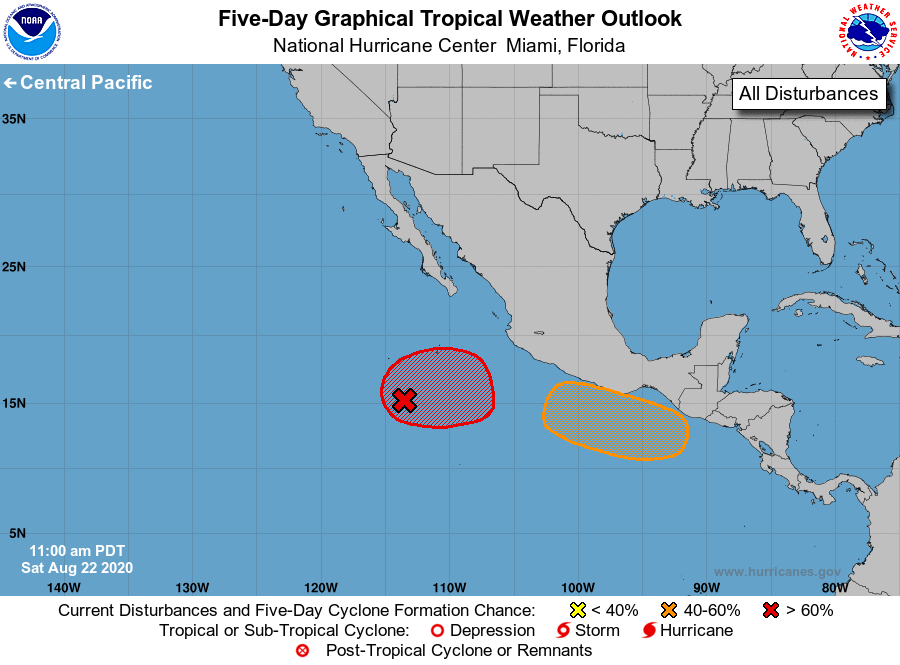
For the eastern North Pacific...east of 140 degrees west longitude:
1. An elongated area of low pressure located several hundred miles
south-southwest of the southern tip of the Baja California peninsula
continues to produce a large area of disorganized cloudiness and
thunderstorms. This system is forecast to drift eastward for the
next couple of days. Conditions appear favorable for gradual
development, and a tropical depression is likely to form during the
early to middle part of next week when the system is expected to
move slowly off the coast of Mexico.
* Formation chance through 48 hours...medium...40 percent.
* Formation chance through 5 days...high...80 percent.
2. Another area of low pressure is likely to form south of the Gulf of
Tehuantepec early next week. A tropical depression could form by
the middle of next week while the system moves slowly northwestward
or northward, near or parallel to the southwestern coast of Mexico.
* Formation chance through 48 hours...low...near 0 percent.
* Formation chance through 5 days...medium...60 percent.
Forecaster Latto