Skip Navigation Links
NOAA NOAA United States Department of Commerce

NHC Graphical Outlook Archive


« Earliest Available         ‹ Earlier         Later ›         Latest Available »
GIS Shapefiles
Central Pacific Eastern Pacific Atlantic

View 2-Day Graphical Tropical Weather Outlook
Click for Atlantic Click for Atlantic

Tropical Weather Outlook Text

ZCZC MIATWOEP ALL
TTAA00 KNHC DDHHMM

Tropical Weather Outlook
NWS National Hurricane Center Miami FL
500 AM PDT Mon Sep 9 2019

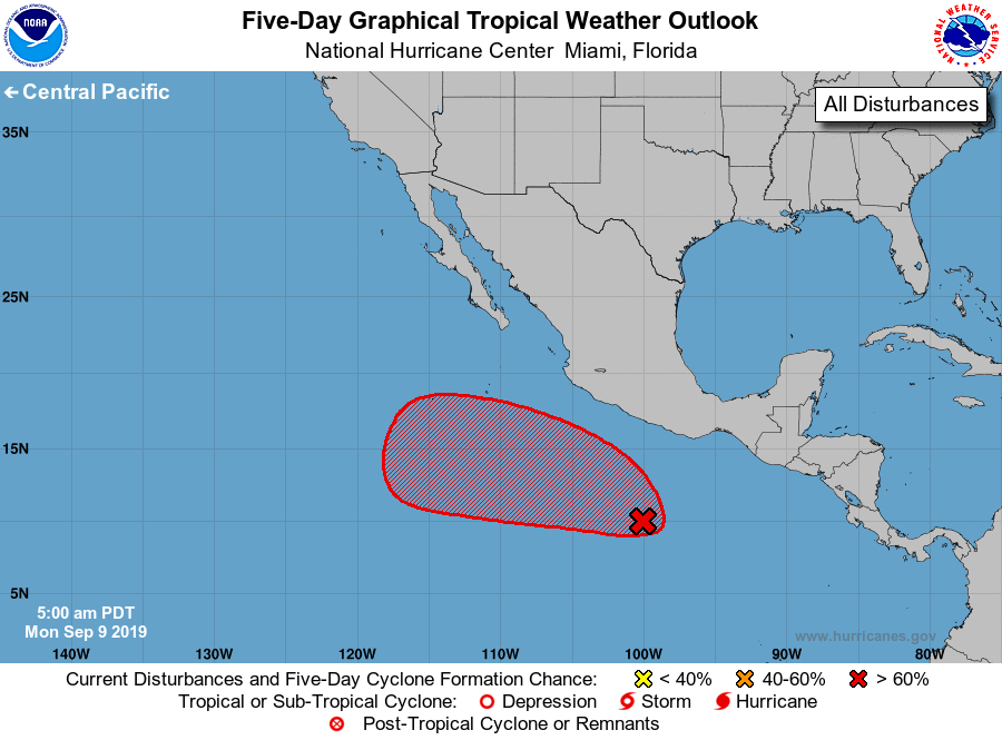
For the eastern North Pacific...east of 140 degrees west longitude:

1. A tropical wave located a few hundred miles south of Acapulco,
Mexico, continues to produce a broad area of disorganized showers
and thunderstorms. Development of this system is anticipated, and a
tropical depression is likely to form during the next few days
while the system moves west-northwestward at 10 to 15 mph.
* Formation chance through 48 hours...medium...40 percent.
* Formation chance through 5 days...high...80 percent.

Forecaster Zelinsky


List of Atlantic Outlooks (May 2023 - present)
List of East Pacific Outlooks (May 2023 - present)
List of Central Pacific Outlooks (May 2023 - present)
List of Atlantic Outlooks (July 2014 - April 2023)
List of East Pacific Outlooks (July 2014 - April 2023)
List of Central Pacific Outlooks (June 2019 - April 2023)
List of Atlantic Outlooks (June 2009 - June 2014)
List of East Pacific Outlooks (June 2009 - June 2014)