ZCZC MIATWOEP ALL
TTAA00 KNHC DDHHMM
Tropical Weather Outlook
NWS National Hurricane Center Miami FL
1100 AM PDT Sat Jul 27 2019
For the eastern North Pacific...east of 140 degrees west longitude:
The National Hurricane Center is issuing advisories on newly formed
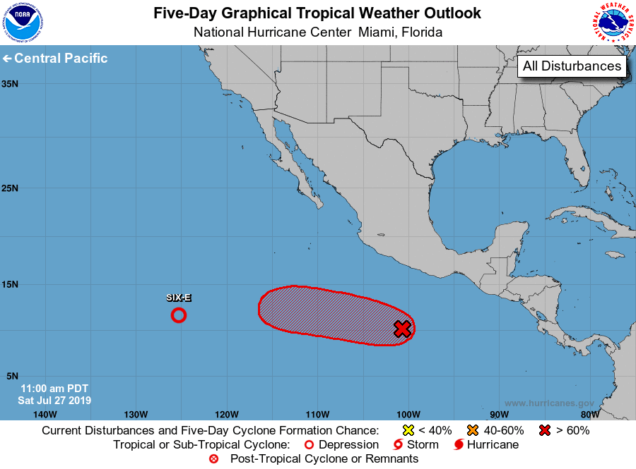
Tropical Depression Six-E located between Mexico and the Hawaiian
Islands.
1. An area of low pressure accompanied by disturbed weather is located
a few hundred miles south of Acapulco, Mexico. Conditions are
favorable for development, and a tropical depression is expected to
form early next week while the system moves generally westward at 15
to 20 mph.
* Formation chance through 48 hours...medium...50 percent.
* Formation chance through 5 days...high...90 percent.
Public Advisories on Six-E are issued under WMO header WTPZ31 KNHC
and under AWIPS header MIATCPEP1. Forecast/Advisories are issued
under WMO header WTPZ21 KNHC and under AWIPS header MIATCMEP1.
Forecaster Avila