ZCZC MIATWOEP ALL
TTAA00 KNHC DDHHMM
Tropical Weather Outlook
NWS National Hurricane Center Miami FL
500 AM PDT Sat Jul 27 2019
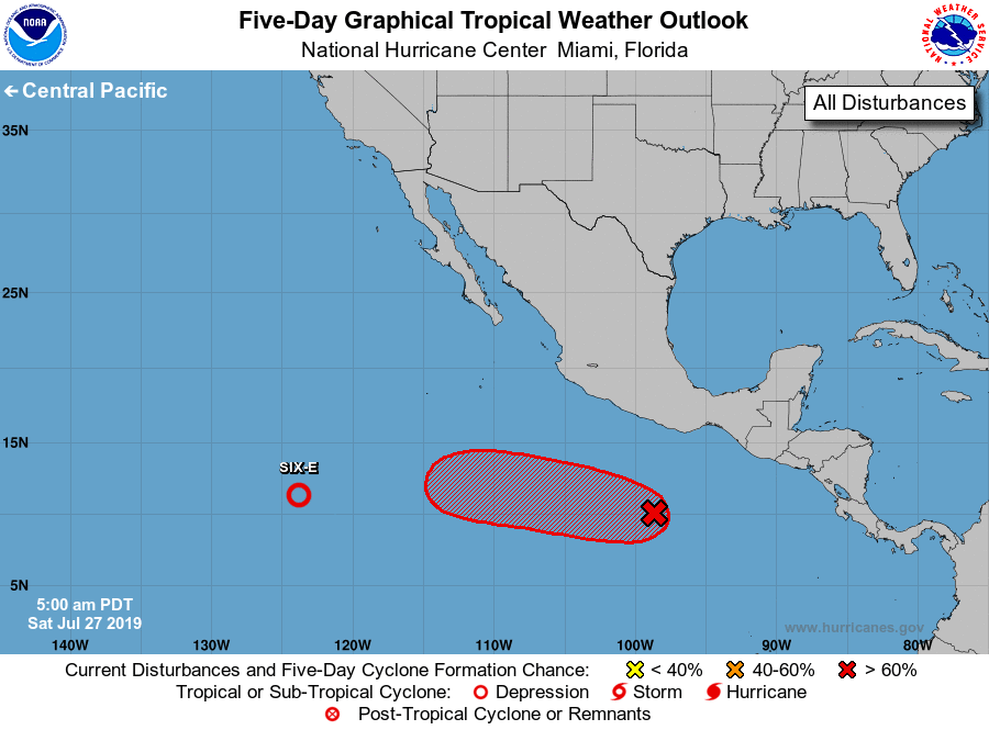
For the eastern North Pacific...east of 140 degrees west longitude:
1. Recent satellite-derived wind data indicate that the disturbance
located about 1200 miles southwest of the southern tip of the Baja
California peninsula is already producing tropical-storm-force winds
in gusts while a low-level center appears to be forming. If it
becomes apparent that a center has formed, advisories will be
initiated later this morning. This system is expected to move
westward to west-northwestward at 10 to 15 mph.
* Formation chance through 48 hours...high...90 percent.
* Formation chance through 5 days...high...90 percent.
2. An area of low pressure accompanied by disturbed weather is located
a few hundred miles south-southwest of the Gulf of Tehuantepec.
Gradual development of this system is expected, and a tropical
depression is likely to form early next week while the system moves
generally westward at 15 to 20 mph.
* Formation chance through 48 hours...low...30 percent.
* Formation chance through 5 days...high...80 percent.
Forecaster Avila