ZCZC MIATWOEP ALL
TTAA00 KNHC DDHHMM
Tropical Weather Outlook
NWS National Hurricane Center Miami FL
1100 AM PDT Sat Jun 29 2019
For the eastern North Pacific...east of 140 degrees west longitude:
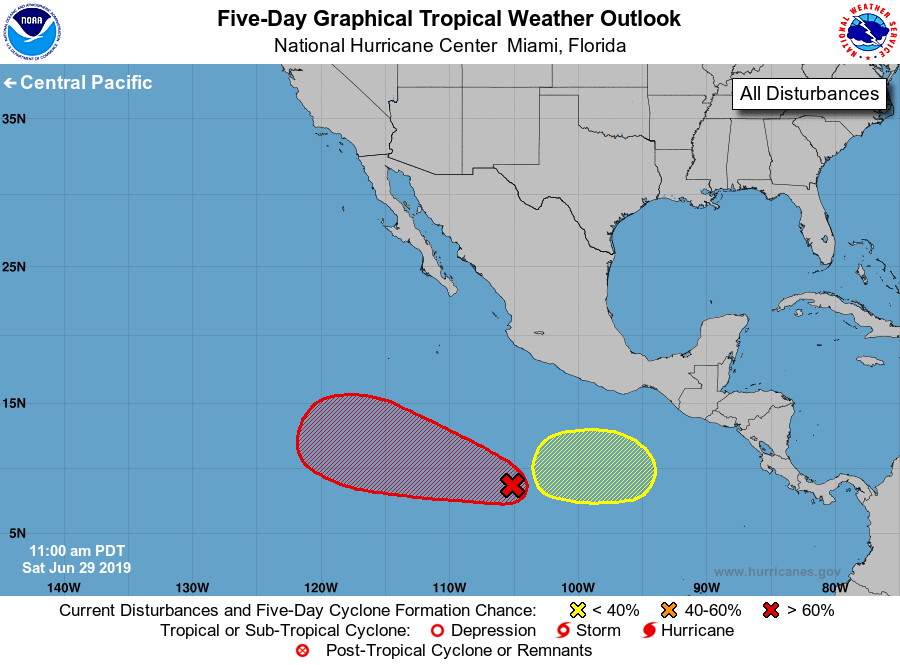
The National Hurricane Center has issued the last advisory on
post-tropical cyclone Alvin located several hundred miles west of
the southern tip of the Baja California peninsula.
1. A broad area of low pressure has developed well to the southwest of
the southern coast of Mexico. The associated showers and
thunderstorms are gradually becoming better organized, and a
tropical depression is likely to form in the next day or two while
the disturbance moves westward to west-northwestward at about 15
mph.
* Formation chance through 48 hours...high...90 percent.
* Formation chance through 5 days...high...90 percent.
2. An area of low pressure is expected to form by the middle of next
week several hundred miles south of the southern coast of Mexico.
Conditions appear favorable for gradual development of this system
while it moves westward to west-northwestward.
* Formation chance through 48 hours...low...near 0 percent.
* Formation chance through 5 days...low...30 percent.
Forecaster Latto/Beven