ZCZC MIATWOEP ALL
TTAA00 KNHC DDHHMM
Tropical Weather Outlook
NWS National Hurricane Center Miami FL
1000 PM PST Tue Nov 27 2018
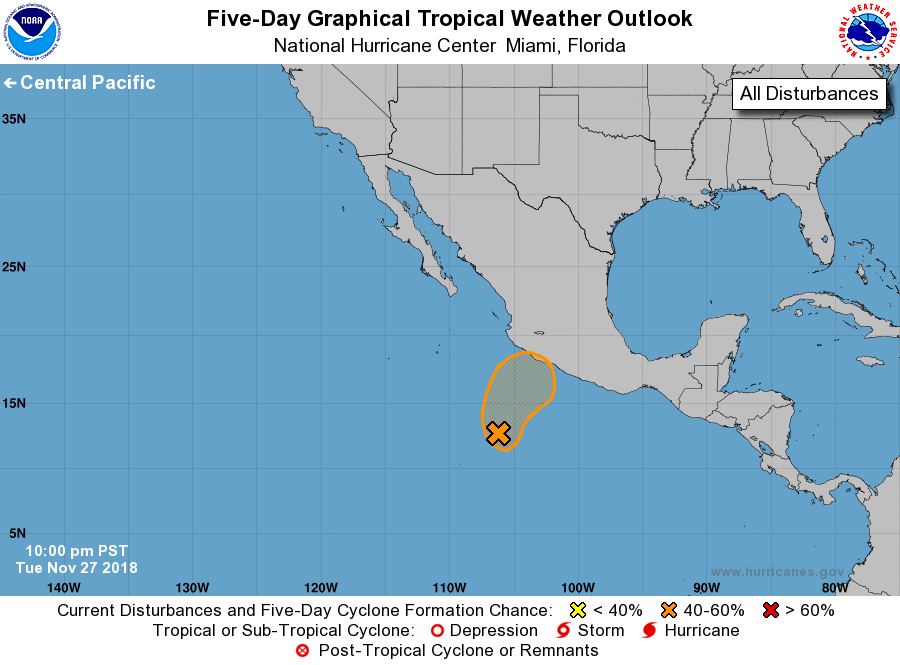
For the eastern North Pacific...east of 140 degrees west longitude:
1. A broad low pressure area located about 425 miles south-southwest of
Manzanillo, Mexico, continues to produce disorganized showers and
thunderstorms. Although upper-level winds are not likely to be
particularly conducive for development, a tropical depression could
still form before environmental conditions become very unfavorable
late Thursday. The disturbance is forecast to turn northeastward
toward southwestern Mexico on Wednesday and approach the coast on
Thursday. Regardless of development, locally heavy rain is expected
across portions of the Mexican states of Guerrero, Michoacan, Colima
and Jalisco through Thursday. These rains could result in
life-threatening flash floods and mudslides.
* Formation chance through 48 hours...medium...40 percent.
* Formation chance through 5 days...medium...40 percent.
Forecaster Blake