ZCZC MIATWOEP ALL
TTAA00 KNHC DDHHMM
Tropical Weather Outlook
NWS National Hurricane Center Miami FL
1100 AM PDT Mon Oct 29 2018
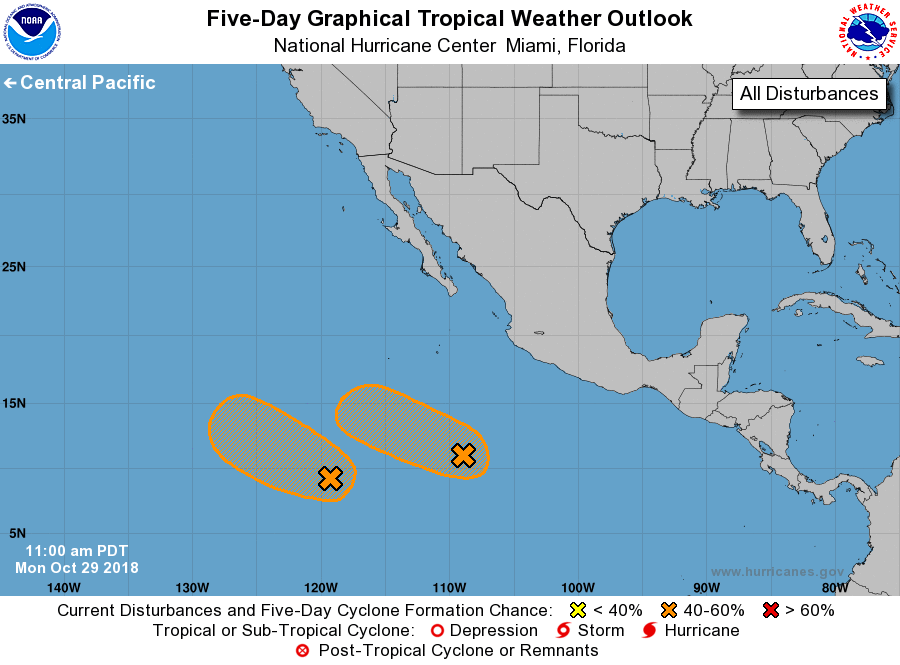
For the eastern North Pacific...east of 140 degrees west longitude:
1. An elongated area of low pressure located about 800 miles south
of the southern tip of the Baja California peninsula has become
less organized over the past 24 hours. Some slow development of this
system is still possible during the next several days while the
system moves westward or west-northwestward at about 10 mph.
* Formation chance through 48 hours...low...20 percent.
* Formation chance through 5 days...medium...40 percent.
2. A well-defined low pressure system located about 1100 miles
south-southwest of the southern tip of the Baja California peninsula
continues to produce disorganized shower and thunderstorm activity.
Some slow development of this system is possible over the next few
days while the low moves toward the west or west-northwest at about
10 mph.
* Formation chance through 48 hours...low...30 percent.
* Formation chance through 5 days...medium...40 percent.
Forecaster Zelinsky