ZCZC MIATWOEP ALL
TTAA00 KNHC DDHHMM
Tropical Weather Outlook
NWS National Hurricane Center Miami FL
500 AM PDT Sun Oct 28 2018
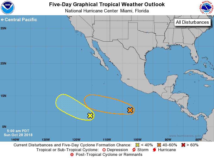
For the eastern North Pacific...east of 140 degrees west longitude:
1. Showers and thunderstorms associated with a small well-defined low
pressure system located several hundred miles south-southwest of
Acapulco, Mexico have increased during the past few hours. Some
additional development of this system is possible and a tropical
depression could form during the next couple of days while it moves
westward at about 10 mph.
* Formation chance through 48 hours...medium...40 percent.
* Formation chance through 5 days...medium...40 percent.
2. An area of low pressure located about 1000 miles south-southwest of
the southern tip of the Baja California peninsula is producing
limited shower activity. Some slow development of this system is
possible over the next several days while the low moves toward the
west or west-northwest at about 10 mph.
* Formation chance through 48 hours...low...10 percent.
* Formation chance through 5 days...low...20 percent.
Forecaster Zelinsky