ZCZC MIATWOEP ALL
TTAA00 KNHC DDHHMM
Tropical Weather Outlook
NWS National Hurricane Center Miami FL
500 AM PDT Tue Aug 14 2018
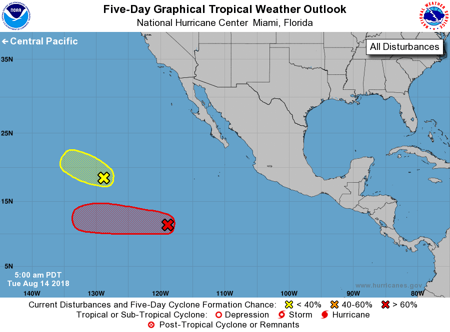
For the eastern North Pacific...east of 140 degrees west longitude:
1. A low pressure system is located just over a 1000 miles southwest of
the southern tip of the Baja California peninsula. Showers and
thunderstorms continue to gradually become better organized, and
environmental conditions are expected to be conducive for a tropical
depression to form during the next couple of days while the
disturbance moves westward at 10 to 15 mph.
* Formation chance through 48 hours...medium...60 percent.
* Formation chance through 5 days...high...90 percent.
2. Shower and thunderstorm activity, associated with a weak low
pressure area located a little over a 1200 miles west-southwest of
the southern tip of the Baja California peninsula, has diminished
considerably during the past several hours. The system is now
moving northwestward over decreasing sea surface temperatures and
into an environment less conducive for any further development
during the next couple of days.
* Formation chance through 48 hours...low...10 percent.
* Formation chance through 5 days...low...10 percent.
Forecaster Roberts