ZCZC MIATWOEP ALL
TTAA00 KNHC DDHHMM
Tropical Weather Outlook
NWS National Hurricane Center Miami FL
1100 PM PDT Mon Aug 13 2018
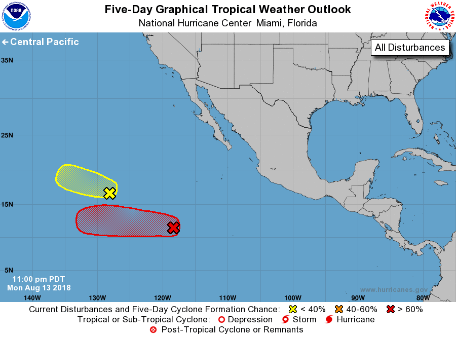
For the eastern North Pacific...east of 140 degrees west longitude:
1. A large low pressure system is located about 950 miles southwest of
the southern tip of the Baja California peninsula. Shower and
thunderstorm activity continues to become better organized, and
environmental conditions are expected to be conducive for a tropical
depression to form during the next couple of days days while the
disturbance moves westward at 10 to 15 mph.
* Formation chance through 48 hours...medium...60 percent.
* Formation chance through 5 days...high...90 percent.
2. A weak low pressure area located about 1250 miles west-southwest
of the southern tip of the Baja California peninsula continues to
produce disorganized showers and thunderstorms. Although some slow
development is still possible during the next day or so, the low is
forecast to reach cooler waters by late Tuesday or Wednesday, which
would limit further development chances.
* Formation chance through 48 hours...low...30 percent.
* Formation chance through 5 days...low...30 percent.
Forecaster Stewart