ZCZC MIATWOEP ALL
TTAA00 KNHC DDHHMM
Tropical Weather Outlook
NWS National Hurricane Center Miami FL
500 AM PDT Fri Aug 11 2017
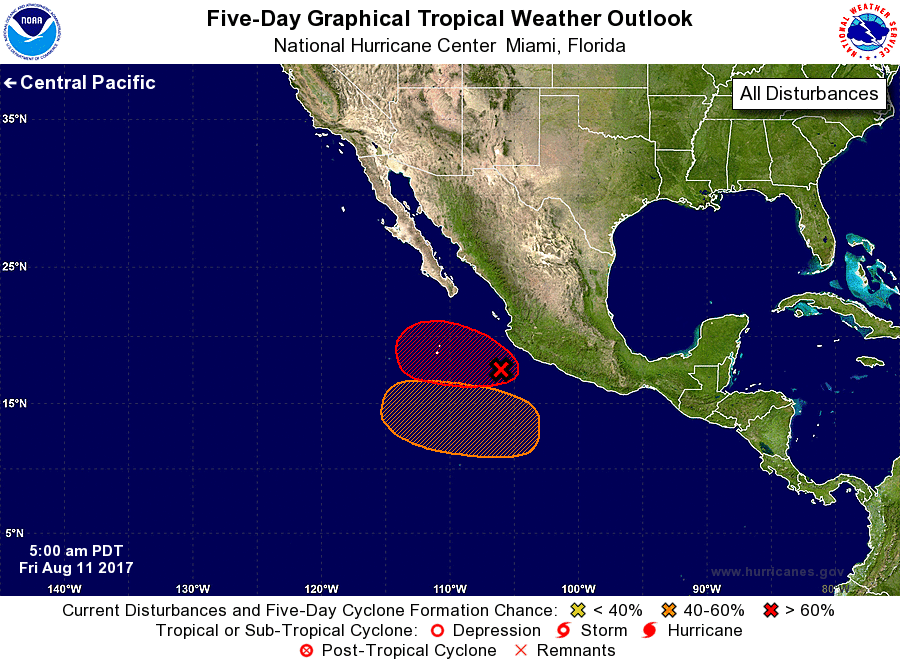
For the eastern North Pacific...east of 140 degrees west longitude:
1. An area of low pressure is located about 160 miles southwest of
Manzanillo, Mexico. Showers and thunderstorms associated with the
system continue to become better organized, and a tropical
depression could be forming. Any additional increase in
organization would result in the issuance of advisories today or
tonight.
* Formation chance through 48 hours...high...90 percent.
* Formation chance through 5 days...high...90 percent.
2. An area of low pressure is forecast to form well south of the coast
of southern Mexico by early next week. Environmental conditions are
expected to be conducive for some slow development of this system as
it moves west-northwestward at 10 to 15 mph.
* Formation chance through 48 hours...low...near 0 percent.
* Formation chance through 5 days...medium...40 percent.
Forecaster Roberts