ZCZC MIATWOEP ALL
TTAA00 KNHC DDHHMM
Tropical Weather Outlook
NWS National Hurricane Center Miami FL
500 AM PDT Sun Jul 30 2017
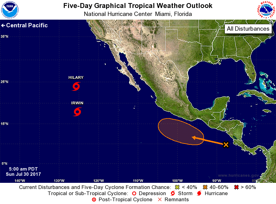
For the eastern North Pacific...east of 140 degrees west longitude:
The National Hurricane Center is issuing advisories on Tropical
Storm Hilary, located about 1000 miles west of the southern
tip of the Baja California peninsula, and on Tropical Storm Irwin,
located more than 1000 miles west-southwest of the southern tip of
the Baja California peninsula.
1. An area of disorganized showers and thunderstorms is located a few
hundred miles south of El Salvador and Guatemala. Environmental
conditions appear conducive for slow development of this disturbance
while it moves west-northwestward at 10 to 15 mph.
* Formation chance through 48 hours...low...near 0 percent.
* Formation chance through 5 days...medium...40 percent.
Forecaster Cangialosi