ZCZC MIATWOEP ALL
TTAA00 KNHC DDHHMM
TROPICAL WEATHER OUTLOOK
NWS NATIONAL HURRICANE CENTER MIAMI FL
500 AM PDT SUN SEP 25 2016
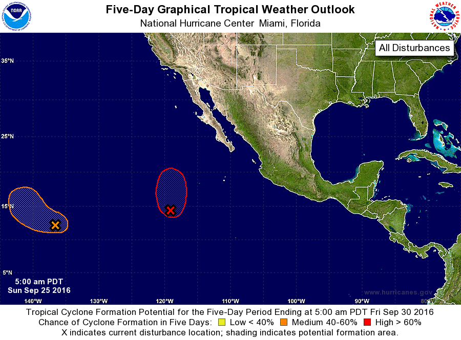
For the eastern North Pacific...east of 140 degrees west longitude:
1. Shower and thunderstorm activity associated with a low pressure
system located about 825 miles southwest of the southern tip of the
Baja California peninsula has become a little better organized
overnight. Satellite imagery also suggests that the circulation
is gradually becoming better defined. Environmental conditions are
conducive for additional development, and a tropical depression is
likely to form later today or tonight while the system moves slowly
northward.
* Formation chance through 48 hours...high...90 percent
* Formation chance through 5 days...high...90 percent
2. An area of low pressure located about 1275 miles east-southeast
of the Big Island of Hawaii continues to produce disorganized
showers and thunderstorms. Any development of this disturbance
should be slow to occur during the next couple of days. After that
time, environmental conditions could become more conducive for
development. This system is expected to move west-northwestward
during the next couple of days, and then turn northward as it
approaches the Central Pacific basin.
* Formation chance through 48 hours...low...10 percent
* Formation chance through 5 days...medium...50 percent
Forecaster Brown