ZCZC MIATWOEP ALL
TTAA00 KNHC DDHHMM
TROPICAL WEATHER OUTLOOK
NWS NATIONAL HURRICANE CENTER MIAMI FL
500 PM PDT WED JUL 27 2016
For the eastern North Pacific...east of 140 degrees west longitude:
The National Hurricane Center is issuing advisories on Tropical
Storm Frank, located several hundred miles west of the southern tip
of the Baja California peninsula.
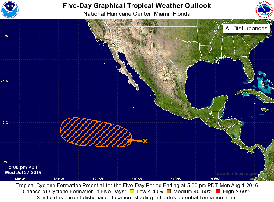
1. Showers and thunderstorms associated with a broad area of low
pressure centered about 650 miles south-southwest of Manzanillo,
Mexico, have increased since yesterday, and the low's circulation
has become better defined. Environmental conditions appear
conducive for additional development of this system, and a tropical
depression could form over the weekend while the low moves
west-northwestward at about 10 mph.
* Formation chance through 48 hours...low...10 percent
* Formation chance through 5 days...medium...60 percent
Forecaster Berg