ZCZC MIATWOEP ALL
TTAA00 KNHC DDHHMM
TROPICAL WEATHER OUTLOOK
NWS NATIONAL HURRICANE CENTER MIAMI FL
1100 AM PDT THU JUN 16 2016
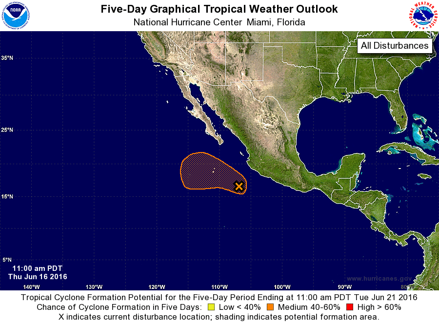
For the eastern North Pacific...east of 140 degrees west longitude:
1. Showers and thunderstorms remain disorganized this morning around
the broad area of low pressure located a few hundred miles southwest
of Manzanillo, Mexico. Environmental conditions appear to be
conducive for some gradual development of this system during the
next day or so, and a tropical depression could still form
while the low moves west-northwestward at around 10 mph.
Over the weekend, conditions are forecast to become less
conducive for tropical cyclone formation.
* Formation chance through 48 hours...medium...60 percent
* Formation chance through 5 days...medium...60 percent
Forecaster Cangialosi