


NHC Graphical Outlook Archive
|
« Earliest Available ‹ Earlier Later › Latest Available » |
GIS Shapefiles |
| Eastern North Pacific | Atlantic |
|
Tropical Weather Outlook Text
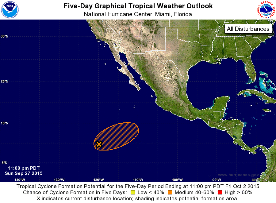
ZCZC MIATWOEP ALL
TTAA00 KNHC DDHHMM

TROPICAL WEATHER OUTLOOK
NWS NATIONAL HURRICANE CENTER MIAMI FL
1100 PM PDT SUN SEP 27 2015

For the eastern North Pacific...east of 140 degrees west longitude:

The National Hurricane Center is issuing advisories on Tropical
Storm Marty, located a couple of hundred miles south-southwest of
Zihuatanejo, Mexico.

1. A trough of low pressure located about 1000 miles south-southwest
of the Baja California peninsula is producing an area of
disorganized cloudiness and showers.  Environmental conditions are
expected to be conducive for some development of this system during
the next several days, however, upper-level winds could become less
favorable by the end of the week while this disturbance moves
east-northeastward or northeastward.
* Formation chance through 48 hours...low...20 percent
* Formation chance through 5 days...medium...60 percent

Forecaster Brown
List of Atlantic Outlooks (May 2023 - present)
List of East Pacific Outlooks (May 2023 - present)
List of Central Pacific Outlooks (May 2023 - present)
List of Atlantic Outlooks (July 2014 - April 2023)
List of East Pacific Outlooks (July 2014 - April 2023)
List of Central Pacific Outlooks (June 2019 - April 2023)
List of Atlantic Outlooks (June 2009 - June 2014)
List of East Pacific Outlooks (June 2009 - June 2014)