


NHC Graphical Outlook Archive
|
« Earliest Available ‹ Earlier Later › Latest Available » |
GIS Shapefiles |
| Eastern North Pacific | Atlantic |
|
Tropical Weather Outlook Text
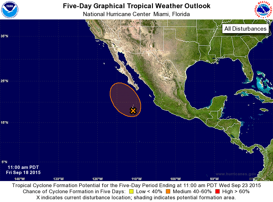
ZCZC MIATWOEP ALL
TTAA00 KNHC DDHHMM

TROPICAL WEATHER OUTLOOK
NWS NATIONAL HURRICANE CENTER MIAMI FL
1100 AM PDT FRI SEP 18 2015

For the eastern North Pacific...east of 140 degrees west longitude:

1. An area of low pressure is centered about 350 miles south of the
southern tip of the Baja California peninsula.  Showers and
thunderstorms have been increasing near the low, and environmental
conditions appear conducive for some additional development through
the weekend while the system moves northwestward or north-
northwestward at 5 to 10 mph.  After that time, colder water and
strong upper-level winds should limit development.  Regardless of
development, heavy rains and flash flooding are possible across
portions of the Baja California peninsula and northwestern mainland
Mexico through the weekend.
* Formation chance through 48 hours...medium...40 percent
* Formation chance through 5 days...medium...40 percent

Forecaster Berg
List of Atlantic Outlooks (May 2023 - present)
List of East Pacific Outlooks (May 2023 - present)
List of Central Pacific Outlooks (May 2023 - present)
List of Atlantic Outlooks (July 2014 - April 2023)
List of East Pacific Outlooks (July 2014 - April 2023)
List of Central Pacific Outlooks (June 2019 - April 2023)
List of Atlantic Outlooks (June 2009 - June 2014)
List of East Pacific Outlooks (June 2009 - June 2014)