


NHC Graphical Outlook Archive
|
« Earliest Available ‹ Earlier Later › Latest Available » |
GIS Shapefiles |
| Eastern North Pacific | Atlantic |
|
Tropical Weather Outlook Text
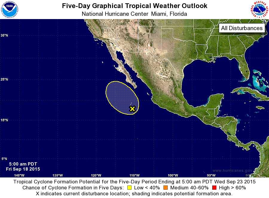
ZCZC MIATWOEP ALL
TTAA00 KNHC DDHHMM

TROPICAL WEATHER OUTLOOK
NWS NATIONAL HURRICANE CENTER MIAMI FL
500 AM PDT FRI SEP 18 2015

For the eastern North Pacific...east of 140 degrees west longitude:

1. An elongated surface trough extends several hundred miles off the
west-central coast of Mexico.  Showers and thunderstorms associated
with this system have increased over the past 24 hours, and a more
well-defined surface circulation is developing within this trough
about 350 miles south of the southern tip of the Baja California
peninsula.  Some additional development of this system is possible
through this weekend while it moves generally northwestward at 5 to
10 mph.  After that time, colder water and stronger upper-level
winds near the Baja California peninsula should limit development.
* Formation chance through 48 hours...low...30 percent
* Formation chance through 5 days...low...30 percent

Forecaster Berg
List of Atlantic Outlooks (May 2023 - present)
List of East Pacific Outlooks (May 2023 - present)
List of Central Pacific Outlooks (May 2023 - present)
List of Atlantic Outlooks (July 2014 - April 2023)
List of East Pacific Outlooks (July 2014 - April 2023)
List of Central Pacific Outlooks (June 2019 - April 2023)
List of Atlantic Outlooks (June 2009 - June 2014)
List of East Pacific Outlooks (June 2009 - June 2014)