ZCZC MIATWOAT ALL
TTAA00 KNHC DDHHMM
Tropical Weather Outlook
NWS National Hurricane Center Miami FL
200 PM EDT Fri Aug 12 2022
For the North Atlantic...Caribbean Sea and the Gulf of Mexico:
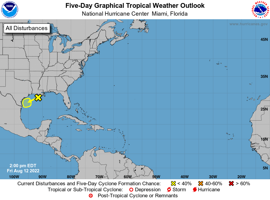
1. 1. Northern Gulf of Mexico:
Disorganized showers and thunderstorms over the north-central Gulf
of Mexico are associated with an area of low pressure centered
just offshore of the southern coast of Louisiana. Development, if
any, of this system is expected to be slow to occur as it drifts
west-southwestward and approaches the Texas coast over the weekend.
Regardless of development, locally heavy rains are possible along
portions of the Texas coast through the weekend. For more
information about the potential for heavy rainfall, please see
products issued by your local National Weather Service office and
the Weather Prediction Center.
* Formation chance through 48 hours...low...10 percent.
* Formation chance through 5 days...low...10 percent.
For more information on the system, see products issued by the
National Weather Service at weather.gov and wpc.ncep.noaa.gov
Forecaster Roberts