ZCZC MIATWOAT ALL
TTAA00 KNHC DDHHMM
Tropical Weather Outlook
NWS National Hurricane Center Miami FL
200 AM EDT Fri Oct 15 2021
For the North Atlantic...Caribbean Sea and the Gulf of Mexico:
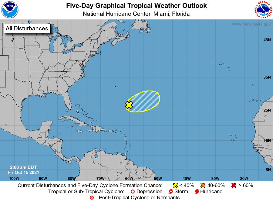
1. Shower and thunderstorm activity associated with an elongated
area of low pressure located more than 500 miles southeast of
Bermuda has become more concentrated to the east and southeast of
the center over the past several hours. Strong upper-level winds,
however, are expected to prevent additional development of this
system through Friday morning. After that time, the low is
forecast to accelerate east-northeastward and merge with a trough of
low pressure ending any further tropical development chance.
Additional information on this system, including gale warnings, can
be found in High Seas Forecasts issued by the National Weather
Service.
* Formation chance through 48 hours...low...10 percent.
* Formation chance through 5 days...low...10 percent.
High Seas Forecasts issued by the National Weather Service
can be found under AWIPS header NFDHSFAT1, WMO header FZNT01
KWBC, and online at ocean.weather.gov/shtml/NFDHSFAT1.php
Forecaster Brown