ZCZC MIATWOAT ALL
TTAA00 KNHC DDHHMM
Tropical Weather Outlook
NWS National Hurricane Center Miami FL
800 AM EDT Fri Oct 23 2020
For the North Atlantic...Caribbean Sea and the Gulf of Mexico:
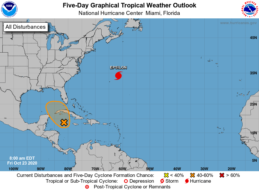
The National Hurricane Center is issuing advisories on Hurricane
Epsilon, located over the west-central Atlantic a couple of hundred
miles northeast of Bermuda.
1. A broad area of low pressure located near Grand Cayman Island is
producing a large area of showers and thunderstorms mainly east and
south of the center. This system has become much better organized
since yesterday, and a tropical depression could form during the
next couple of days while the low moves slowly toward the northwest.
This system is now anticipated to move near western Cuba this
weekend and move slowly across the southeastern Gulf of Mexico by
early next week. Regardless of development, locally heavy rainfall
will be possible over portions of the Cayman Islands, Cuba,
southern Florida and the Keys, and the northwestern Bahamas through
the weekend.
* Formation chance through 48 hours...medium...50 percent.
* Formation chance through 5 days...medium...60 percent.
Forecaster Blake/Papin