ZCZC MIATWOAT ALL
TTAA00 KNHC DDHHMM
Tropical Weather Outlook
NWS National Hurricane Center Miami FL
800 PM EDT Thu Aug 13 2020
For the North Atlantic...Caribbean Sea and the Gulf of Mexico:
The National Hurricane Center is issuing advisories on Tropical
Storm Josephine, located over the tropical Atlantic Ocean several
hundred miles east-southeast of the northern Leeward Islands.
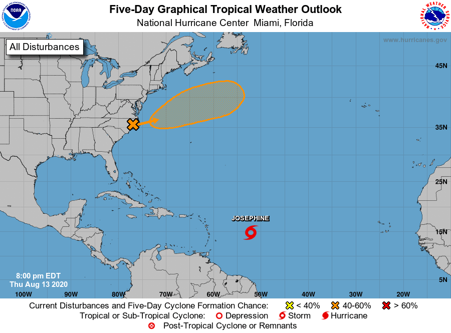
1. A broad area of low pressure over eastern North Carolina is
forecast to move east-northeastward across the north Atlantic well
to the southeast of New England and to the south of the Canadian
Maritime provinces over the next several days. This system could
acquire some subtropical or tropical characteristics during the next
few days while it moves over warm sea surface temperatures of the
Gulf Stream.
* Formation chance through 48 hours...low...30 percent.
* Formation chance through 5 days...medium...40 percent.
Forecaster Roberts