ZCZC MIATWOAT ALL
TTAA00 KNHC DDHHMM
Tropical Weather Outlook
NWS National Hurricane Center Miami FL
800 AM EDT Sun Aug 2 2020
For the North Atlantic...Caribbean Sea and the Gulf of Mexico:
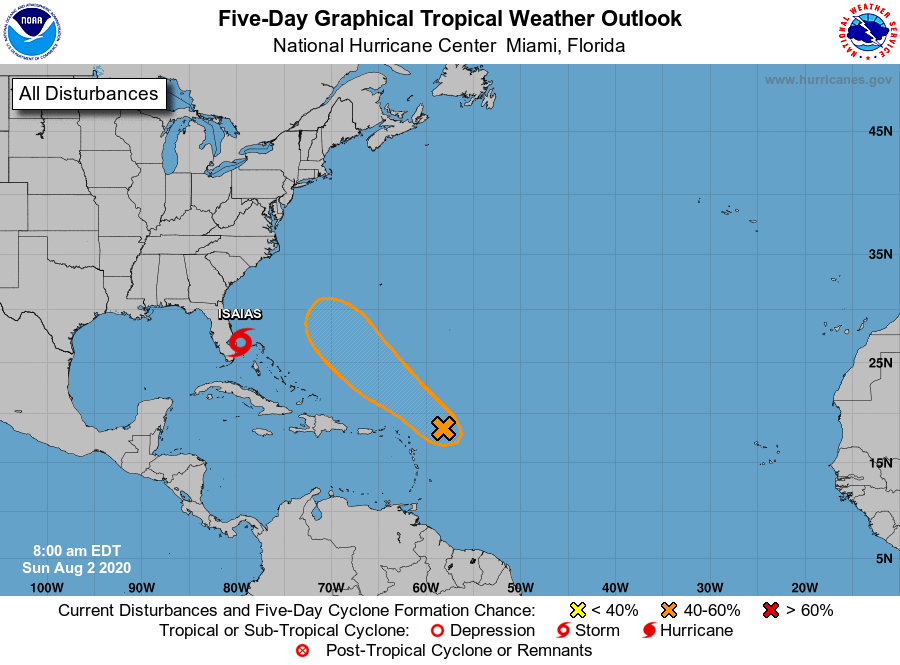
The National Hurricane Center is issuing advisories on Tropical
Storm Isaias, located between the northwestern Bahamas and
southeastern Florida.
1. Showers and thunderstorms associated with a tropical wave located a
a few hundred miles east of the Leeward Islands have changed little
in organization this morning. However, environmental conditions are
forecast to be conducive for additional development during the next
few days, and a tropical depression could form by the middle of the
week. This system is forecast to turn northwestward and then
northward over the western Atlantic, passing north of the Leeward
Islands on Monday and Tuesday.
* Formation chance through 48 hours...low...30 percent.
* Formation chance through 5 days...medium...60 percent.
Forecaster Latto