ZCZC MIATWOAT ALL
TTAA00 KNHC DDHHMM
Tropical Weather Outlook
NWS National Hurricane Center Miami FL
800 AM EDT Fri Jul 24 2020
For the North Atlantic...Caribbean Sea and the Gulf of Mexico:
The National Hurricane Center is issuing advisories on Tropical
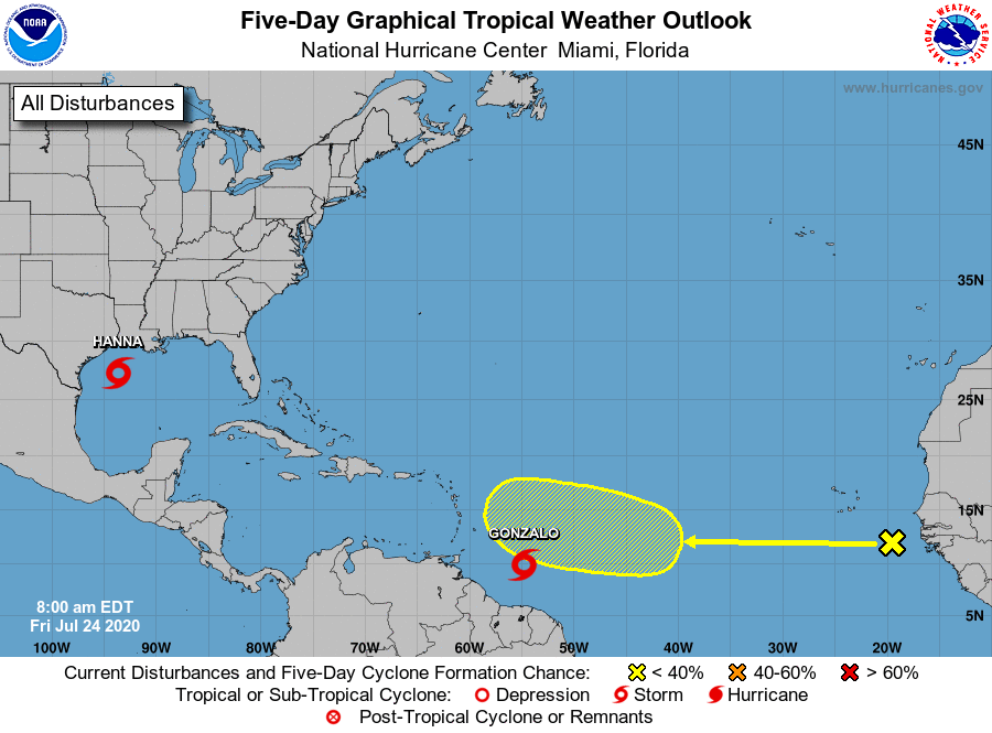
Storm Gonzalo, located less than 600 miles east of the southern
Windward Islands.
The National Hurricane Center is also issuing advisories on
Tropical Storm Hanna, located over the west-central Gulf of Mexico
less than 300 miles east of Corpus Christi, Texas.
1. A tropical wave located about 300 miles southeast of the Cabo Verde
Islands is producing an area of cloudiness and disorganized
thunderstorms. The disturbance is expected move westward across the
tropical Atlantic during the next several days, and some gradual
development of this system is possible by early next week when it
reaches the western tropical Atlantic.
* Formation chance through 48 hours...low...near 0 percent.
* Formation chance through 5 days...low...30 percent.
Forecaster Stewart